
HOME
In the Vale of Avalon

![]()
![]()
![]()
![]()
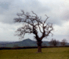
Yet, when I was taking the picture of the Tor from Pennard Hill (link at the side of this page), a farmer stopped and asked me what I was photographing. I tried to show him, but he simply couldn't see it; to him, the Tor was well-nigh invisible. He walked away, shaking his head at my strange behaviour.
As it happens, Pennard Hill provides an interesting lesson in the the multi-layered nature of English place-names.
You see, in Welsh (Romano-British), PEN means hill. In a slightly different version of Gaelic (more common in Ireland and Scotland), ARD means hill. So, Pennard Hill is "Hill Hill Hill". For generation after generation, newcomers to the region have been referred to "that hill over there" - and completely failed to understand. A few more millennia, and the name may be longer than the hill.
We'll get to Glastonbury itself, soon enough, but we should pay a little attention to its surroundings - the Somerset Levels - which help to emphasise the Tor's grandeur. In English usage, the word "Levels" implies more than just flat land - it is land which has been reclaimed or defended from the sea by the creation of drainage channels. Existing rivers (like the Brue and the Parrett), which tend to meander their last few miles to the sea, are straightened, and field ditches are dug and maintained to feed runoff water into these channels.
In fact, the land here dips away from the sea-shore, so these channels have to work especially hard, to shift the runoff from the Mendips in the East, the Poldens to the South and Exmoor to the West.The sea itself doesn't help much - there's a 40 foot tide range in the Severn Estuary (that's the third highest in the world). There are 200 square miles below the high water mark. The lowest spot, close to Glastonbury, is 18 feet below this crucial height.
Without these efforts, Glastonbury would be an island for most of the year - as was the case until the drainage works of the 18th century. Even after that, the region suffered horrendous, destructive floods. As recently as 1981, 10,000 acres of farmland were inundated. After that, further work was carried out on the drainage system. When similar tidal and rainfall conditions were repeated in 1991, only 1,000 acres were flooded.
Then, in 2014, over 16,000 acres were flooded. Many farms were drowned out of business. There was much anger - and charges that dredging of the river system had been neglected. There hasn't been a major flood since but, with climate change, the future can't be guaranteed.
Glastonbury itself hasn't suffered a catastrophic flood for centuries - the centre of town is a whole 100 feet above (mean) sea level - even though the fear of such disaster is never far away from the people of this area.
There is a wonderful evocation of a fictional 20th century flood in "A Glastonbury Romance" by John Cowper Powys (a quiet favourite of mine). So powerful is the writing, that many people came to believe that it actually happened (including myself - until I did the research).